Something a little different this week…
Living in the twenty-first century as we do, with access to Google Earth, Google maps, and all manner of other online (mostly satellite based) cartographical apps literally at our fingertips, it’s all too easy to forget that a few centuries ago much of the world was mysterious, and reliable maps relatively rare.
Map making went through a kind of quantum leap in Europe in the sixteenth century. That, after all, was when Europe discovered the rest of the world. If you were sailing from, say, Marseille, France, to Livorno, Italy, back then, you could get by without a detailed map. Such voyages were relatively short, with lots of places along the way where you could stop. And there were lots of people who had sailed the route before and so could navigate for you. However, if you were sailing from Lisbon to Calcutta, or from Seville to Mexico City, or London to Jamestown… a reliable, accurate map could make the difference between a successful (i.e., a profitable) voyage and disastrous failure and death.
So Europeans got serious about creating reliable maps.
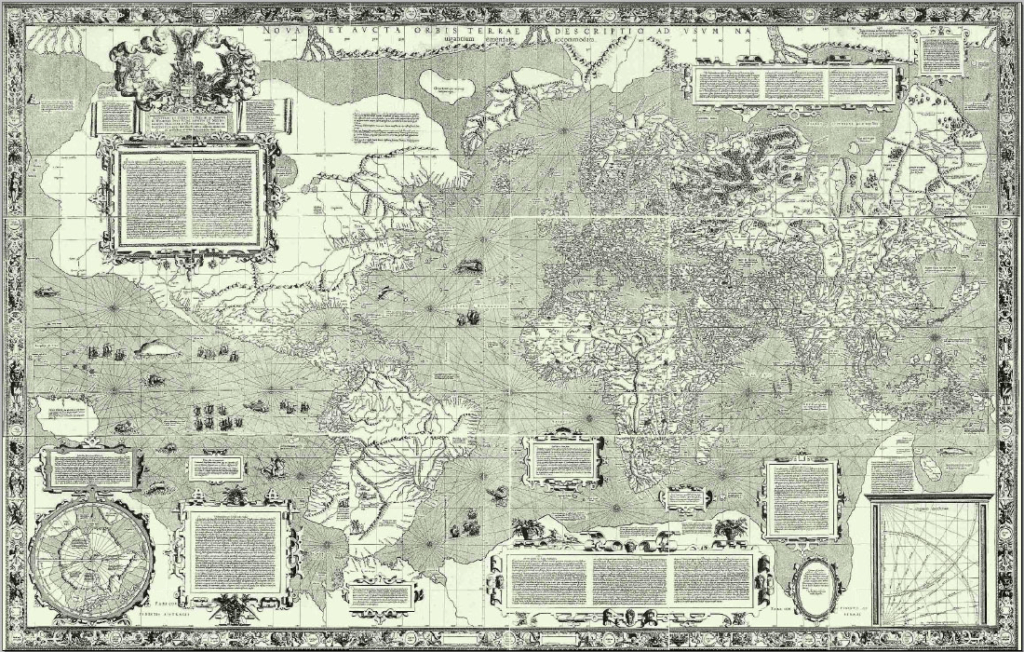
The name pretty much everybody knows from this period is Gerardus Mercator. He’s the guy after whom the “Mercator projection”—the familiar depiction of the world on a flat map that enlarges the size of landmasses near the poles—was named. Mercator and the other mapmakers from this period did amazing work considering they had no aerial images of any sort to draw from.
The map below is one of Mercator’s—a map of the world published in 1569. It’s not really an accurate depiction of the world, but you can recognize all the basic outlines of the continents. Pretty impressive considering what he had to work with.
The sixteenth century was not only the century of new maps. It was also the century of atlases. These atlases included maps, but they also added bird’s-eye views of places—as if you were standing on a hilltop looking down at a particular city.
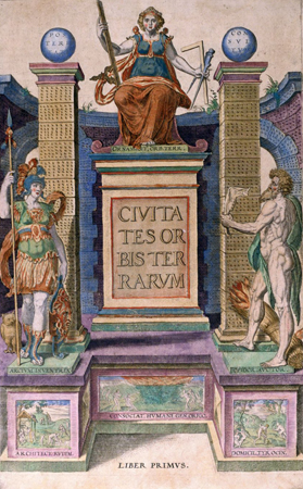
One of the most famous of these sixteenth century atlases was the Civitates orbis terrarium (Cities of the Terrestrial Globe – that is, Cities of the World). It was published in six volumes, from 1567 to 1617. Each of these volumes had its own title, and, strictly speaking, the title Civitates orbis terrarium applies only to the first volume, but it gets used to refer to all six volumes in the series.
Here are the volumes, along with the titles and dates of first publication:
- Civitates orbis terrarum, 1572
- De praecipuis, totius universi urbibus, liber secundus, 1575
- Urbium praecipuarum totius mundi, liber tertius, 1581
- Urbium praecipuarum totius mundi, liber quartus, 1588
- Urbium praecipuarum mundi theatrum quintum, 1596
- Theatri praecipuarum totius mundi urbium liber sextus, 1617
The Civitates orbis terrarium began as a modest project, but it proved so popular and created such a demand that it ended up becoming nothing less than an atlas of all the cities of the world as it was then known.
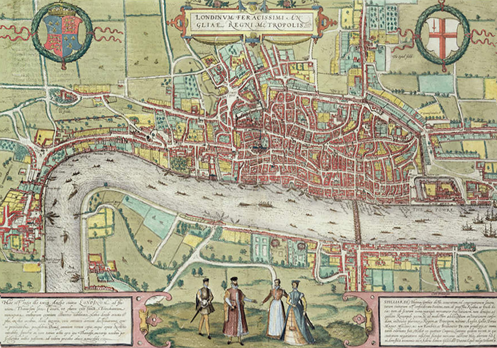
The images were originally printed as copper-plate engravings and then hand tinted. The results were quite spectacular. Below, for instance, is an image of sixteenth century London (a combination of map and birds-eye view):
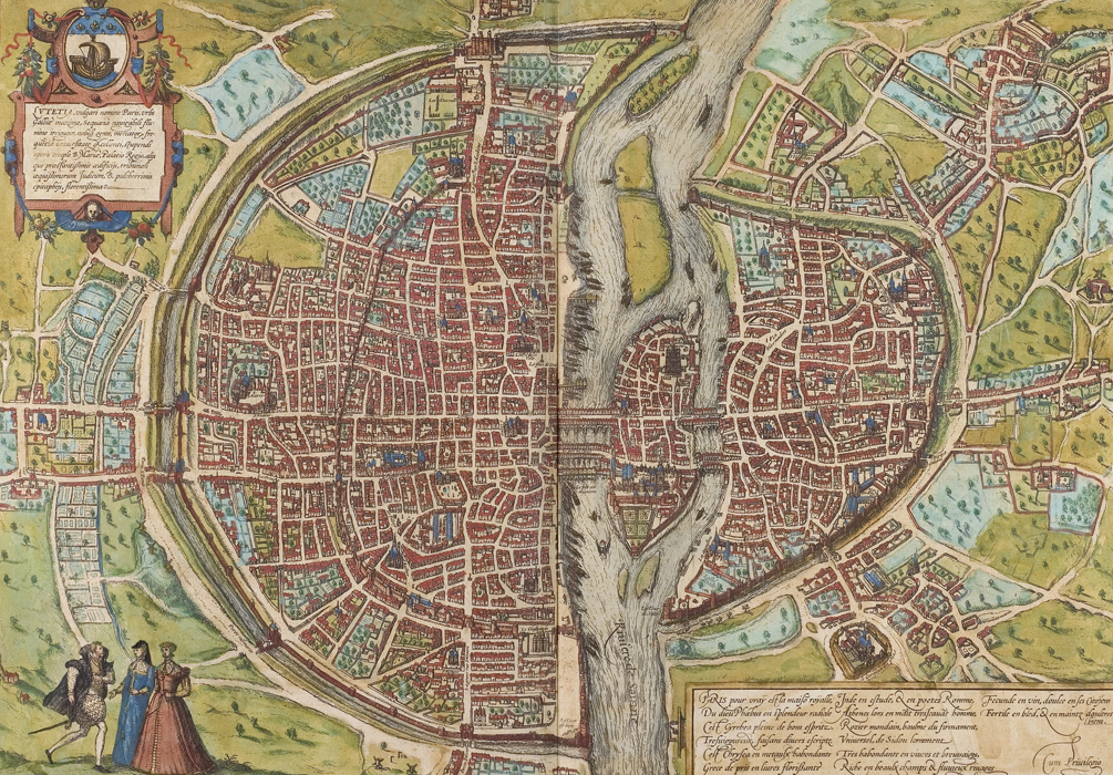
Here is Paris (basically a map):
Here’s a birds-eye view of Barcelona, Spain (complete with ardent lovers in the left foreground):

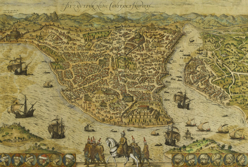
The Civitates orbis terrarium didn’t only depict European cities. Below, for instance, is a bird’s-eye view of Constantinople/Byzantium/Istanbul:
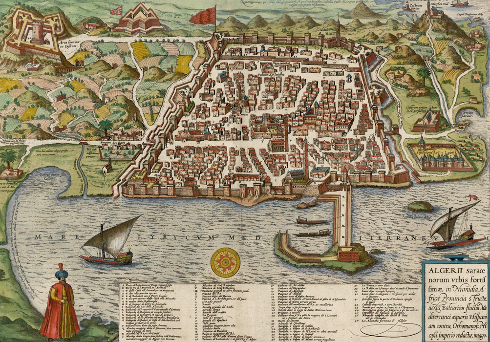
The Civitates orbis terrarium also depicts North African corsair cities. Here’s a bird’s-eye view of Algiers:
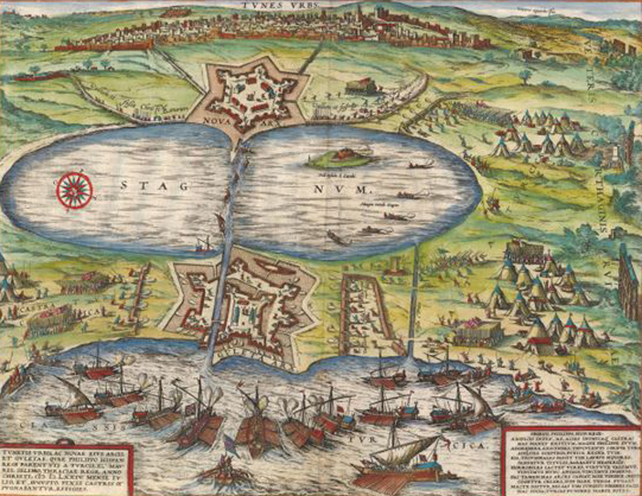
Here’s Tunis:
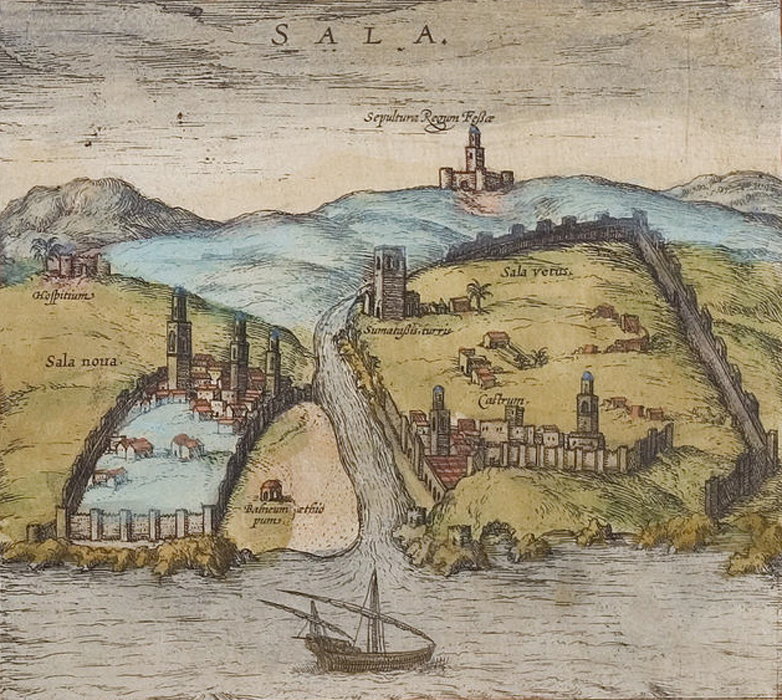
Here’s Salé (labelled as “Sala”):
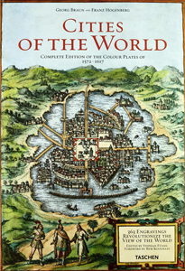
You can buy facsimile versions of Civitates orbis terrarium in varying sizes (I have one that’s 14½” by 10” by 3” thick) that faithfully reproduce the original images in full color—all sold at very reasonable prices. Examining the details of such old images can provide hours of fascination (if you’re that way inclined, of course). Here’s the cover image of the book I own:
You can also access many of the images from Civitates orbis terrarium online. One website in particular is especially interesting. Not only does it provide a selection of images of different cities, it provides maps on which the locations of the cities are flagged so that you can match up the image of each city with its geographical location.
Here’s the link: Civitates orbis terrarium
One last image…
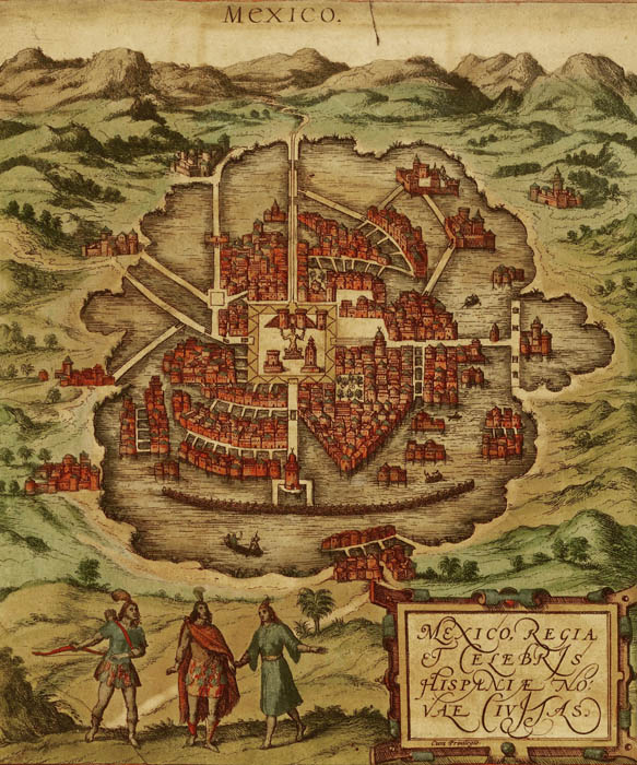
Civitates orbis terrarium included New World cities as well, like this bird’s-eye view of Mexico City (this is a higher resolution version of the image on the cover of the edition of Civitates orbis terrarium that I own) :
Altogether amazing stuff…
 The Travels of Reverend Ólafur Egilsson
The story of the Barbary corsair raid on Iceland in 1627
Amazon listing