This week, we continue with the excerpt from Of the Beginnings, Practices, and Suppression of Pirates, written by Captain Henry Mainwaring, the (in)famous seventeenth century English pirate.
This excerpt, remember, details the ports and harbors used by pirates.
Once again, I have taken some minor editorial liberties with Mainwaring’s text, as well as modernizing some of the archaic spellings, words, and expressions to make the text clearer. I have also again added footnotes explaining some of the more obscure terms and identifying the locations mentioned.
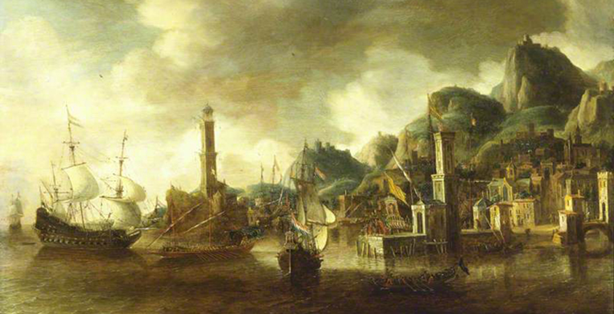
From the middle of May till the middle of August, the pirates are seldom on the Spanish coast, because in those months there is less trading, and, in those fair seasons, the Spanish and Flemish men of war do more diligently keep the seas than in winter weather. So these times they commonly spend among the South or West Islands, and from thence either to the Bank of Newfoundland, [1] where they may easily be fitted with all necessaries, and so into the main [2] to trim, [3] or they do so in Ireland, still intending to be along the Coast of Spain by the middle of August.
A good voyage may be made upon the Coast of Guinea, [4] but because pirates are seldom so well victualled as is requisite for so long a course, and because the place is infectious, [5] and the course long to fetch up to windward again, they seldom or never go south of the Canaries.
At Arzilla, betwixt Cape Spartel and El Araish, [6] being on the coast of Barbary, they may sell goods well, and have fresh victuals.
At Salé, [7] if it be fair weather, they may ride before the Bar, [8] and have victuals and water, and sell goods well, but for the most part the sea breaks so on the Bar that they can hardly water.
At Fidallah [9] they may sell goods very well, have store of victuals, good ballast, and ground a ship that draws nine foot, but here is no drinking water; besides if the wind comes to the north-west, it is a most dangerous road. [10]
At Saffi [11] a man may sell goods well, have fresh water and victuals, but the road is dangerous if the wind comes to the southward of the southeast, so that then they must put out; yet the sea will give them warning of any foul weather. Besides the Castle cannot defend them, [12] because of which they seldom stay, though they stop there.
At Mogador [13] they sell goods well, and have fresh victuals, but no drinking water. On the Islands at that time of the year, there is great store of young hawks and pigeons, which they eat, and here they use much. At Santa Cruz [14] they may water, wood, ballast, have fresh victuals, sell their goods, and ride safe under the Castle; the road is very good also, so that there they stay long and use much.
At Massa, [15] 5 leagues to the southward of Santa Cruz, they sell goods very well, and have fresh victuals and water, but they have to ride far off, and the road is dangerous, so that they must be beholding to the Moors for their necessaries or else they can do nothing. This is the farthest southward that they go on the Barbary coast, unless very rarely some go to Rio d’Oro [16] where they can have nothing but drinking water.
In the Canary Islands they may water at Lanzarote [17] and in the Calmes, [18] but if they do stay more than a single day there, the islanders will entrench themselves in the sand and cut them off.
On the bank of Newfoundland they easily get bread, wine, cider, and fish enough, with all necessaries for shipping. In Newfoundland, if they be of good force, they will command all the land, since the fishermen will not protect each other, and so may a small man [19] fit himself in divers places of the land, where there be but a few ships because the course there is very long, and the wind so very apt to be betwixt the west and northwest that, unless they come by the middle of June, they may (if they be not well fitted) be starved during the passage.
In the out Isles of Scotland and in divers places thereabouts, they may trim well and in the Isles have any provision they have; but because we have little trade into those places, there be few that know them, and so for want of Pilots they seldom come thither. Within St. George’s Channel at Milford and the coast of Wales, they may trim, but because the coast and Channel are dangerous and that for the most part one of your Highness’ ships is either at Milford or at Dublin, they use seldom thither unless it be some small nimble Ship.
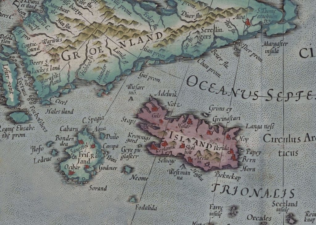
I never was at Iceland or Friesland, [20] and therefore can say nothing on my own knowledge about what they may do there; yet I have heard, and judge it may be true, that there among the fishermen they may fit themselves with men and victuals. Yet this I know by experience of those I have met who have been there, and by the necessity of their voyage, that all those that go for Iceland or Friesland must and do stop in Ireland, as they go back for the coast of Spain, to make clean their ships, and this place have I reserved for the last, in regard that it is most frequented by them, where besides having all commodities and conveniences that the places do afford them, they have also good store of English, Scottish, and Irish wenches which resort unto them, and these are strong attractors to draw the common sort of pirate thither.
[1] “The Bank of Newfoundland” refers to the Grad Banks, the great fishing grounds off the coast of Newfoundland.
[2] …”the main”… It is not entirely clear here what this term refers to, but the term “the main” typically meant the Spanish Main, the swath of territory bordering the Caribbean, stretching from north coast of South America to Florida, that was controlled by Spain.
[3] The term “trim” could be used in a general sense to refer to the process of revictualling, refitting, and generally setting things to rights aboard a ship in preparation for a voyage. The term also had a more specifically use, though, referring to the process of careening: hauling a ship ashore and scraping (trimming) the wooden hull to clean it of barnacles, weeds, etc. This cleaning not only helped prevent rot but also reduced drag and so increased sailing speed, an important factor when a pirate ship was chasing potential prey (or evading pursuit).
[4] “the Coast of Guinea” refers to the West African coast.
[5] The phrase “the place is infectious” means “the place is filled with infectious diseases.”
[6] “Arzilla” corresponds to modern Asilah, on the Atlantic coast of Morocco, about 35 miles (56 kilometers) south of the Strait of Gibraltar. “Cape Spartel” is the northernmost tip of Morocco, where it forms the southern bank of the Strait of Gibraltar. “El Araish” corresponds to modern Larache, on the Atlantic coast of Morocco, about 50 miles (80 kilometers) south of the Strait of Gibraltar.
[7] Salé is located about 120 miles (193 kilometers) south of El Araish, 170 miles (275 kilometers) south of the Strait of Gibraltar. When Mainwaring was active as a pirate captain (1612-1615), Salé had not yet grown into the major corsair capital that it would become from the mid/late 1620s onwards.
[8] “The Bar” refers to the shifting sandbar that partially blocked the entrance to the harbor at Salé.
[9] “Fidallah” corresponds to modern Mohammedia, on the Atlantic coast of Morocco, located about 35 miles (56 kilometers) south along the coast from Salé, 205 miles (330 kilometers) south of the Strait of Gibraltar.
[10] The term “road” refers to the stretch of open, deeper—and so usually safer—water outside a harbor where ships could anchor, sometimes also called a “roadstead.”
[11] “Saffi” is modern Saffi, on the Atlantic coast of Morocco, located about 150 miles (300 kilometers) south along the coast from Fidallah, 355 miles (571 kilometers) south of the Strait of Gibraltar.
[12] The term “castle” refers to the fort overlooking the harbor. Mainwaring refers to the “castles” of various ports, specifying which ones protect their harbors successfully and which don’t. The effectiveness of a particular “castle” would have been determined by how closely it was located to the harbor and how many canon it contained.
[13] “Mogador” corresponds to modern Essaouira, on the Atlantic coast of Morocco, about 60 miles (95 kilometers) south along the coast from Saffi, 415 miles (668 kilometers) south of the Strait of Gibraltar.
[14] “Santa Cruz” (from the Portuguese Santa Cruz do Cabo de Aguer) corresponds to modern Agadir, on the Atlantic coast of Morocco, about 30 miles (48 kilometers) south along the coast from Mogador, 445 miles (716 kilometers) south of the Strait of Gibraltar.
[15] “Massa” corresponds to modern Zaouit Massa, on the Atlantic coast of Morocco, about 30 miles (48 kilometers) south along the coast from Santa Cruz, 475 miles (765 kilometers) south of the Strait of Gibraltar. Mainwaring’s estimate of the distance between Massa and Santa Cruz is a little off: 5 leagues would be about 17 miles/27 kilometers.
[16] “Rio d’Oro” corresponds to modern Península de Río de Oro, in Western Sahara, located about 270 miles (435 kilometers) due south of the Canary Islands, about 1,000 miles south of the Strait of Gibraltar.
[17] Lanzarote is the northeastern most of the Canary Islands.
[18] It is not entirely clear what exact location Mainwaring is referring to by “the Calmes,” but it is likely the Costa Calma on the southeast coast of the island of Fuerteventura, the island immediately south of Lanzarote, in the Canary Islands.
[19] The term “a small man,” means a small ship.
[20] “Friesland” here does not correspond to the Dutch province of that name. Instead, it refers to an island once thought to exist in the North Atlantic southwest of Iceland. Friesland (also spelled Frisland or Frislandia) regularly appeared on maps of the North Atlantic from about the middle of the sixteenth through the middle of the seventeenth centuries.
For those who may be interested…
The above excerpt from Of the Beginnings, Practices, and Suppression of Pirates is taken from the Life and Works of Sir Henry Mainwaring, volume 2 (printed for the Navy Records Society, 1922), (pp. 33-39).
 The Travels of Reverend Ólafur Egilsson
The story of the Barbary corsair raid on Iceland in 1627
Amazon listing